Enhanced Risk of Severe Storms with Damaging Winds, Large Hail, and Tornadoes Declared Across Kansas and the Central Plains This Afternoon and Tonight
NORMAN, OK – The Storm Prediction Center has issued an Enhanced Risk for severe weather across parts of the Central Plains for this afternoon and tonight, signaling a heightened threat of dangerous thunderstorms capable of producing damaging winds, large hail, and possible tornadoes as the system moves through the region.
Enhanced Risk Zone Centers on Kansas and Surrounding States
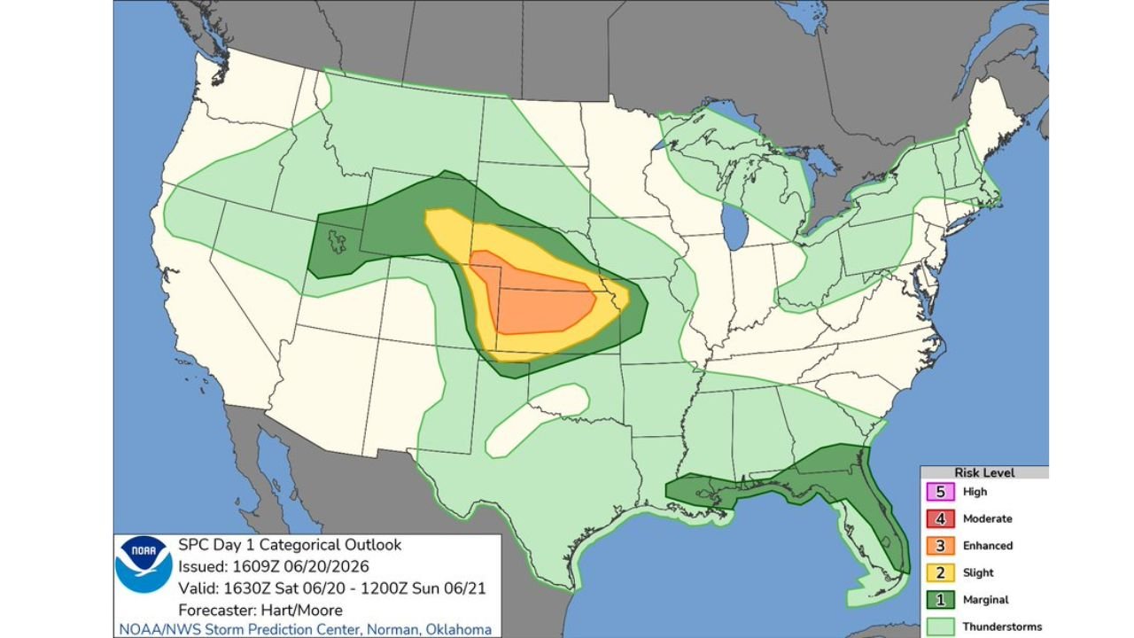
The outlook, issued at 11:11 AM CDT and valid from 1630Z Saturday, June 20 through 1200Z Sunday, June 21, places the core of the threat over portions of Kansas, with the Enhanced Risk area extending into parts of neighboring states. A smaller embedded Slight Risk zone sits at the center of the outlook, indicating where the most organized and intense storm activity is expected to develop.
Surrounding the Enhanced Risk area, a much broader Marginal Risk zone stretches across a large portion of the Central Plains and Midwest, covering areas from the Dakotas down through Texas and east into the Ohio Valley. This wider zone signals that thunderstorms capable of producing some severe weather are possible well beyond the highest risk area.
What an Enhanced Risk Means for Residents
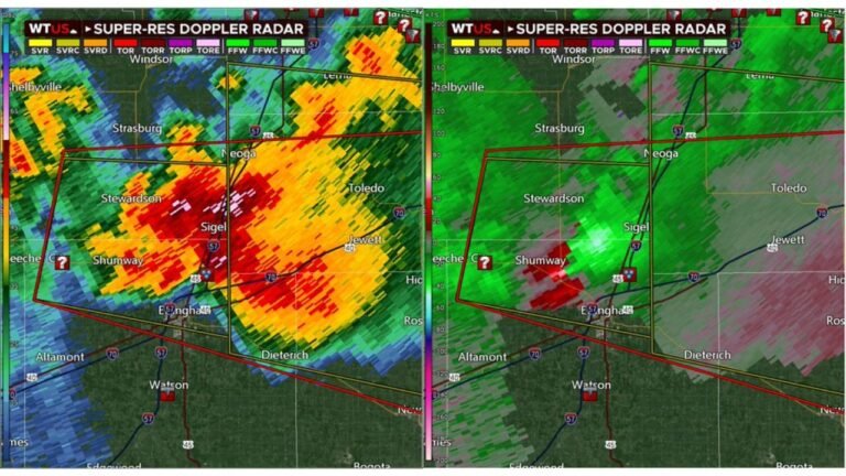
An Enhanced Risk is the third tier on the SPC’s five level outlook scale, sitting above Marginal and Slight but below Moderate and High. It indicates forecasters expect numerous severe thunderstorms with the potential for damaging wind gusts, large hail, and a few tornadoes within the highlighted zone. Residents in and around the affected areas should stay weather aware throughout the afternoon and evening as storms develop and intensify.
Separate Severe Threat Also Expected Across Florida
The outlook also highlights a Thunderstorm risk zone stretching across much of Florida, indicating the potential for general thunderstorm activity in addition to the more serious threat developing over the Plains. While this area is not under the same level of concern as the Central Plains, residents should still monitor local forecasts as conditions evolve.
Stay Weather Aware as Storms Develop This Evening
Forecasters with the NOAA Storm Prediction Center in Norman, Oklahoma noted the outlook was prepared by forecasters Hart and Moore, with conditions expected to evolve through the overnight hours. Anyone in the highlighted risk areas should keep a way to receive weather alerts active and have a plan in place in case warnings are issued later today.
This severe weather setup over the Central Plains is developing quickly and could escalate as the afternoon heating peaks. Stay with pinewhispers.net throughout the day for updates as this storm system unfolds across the region.