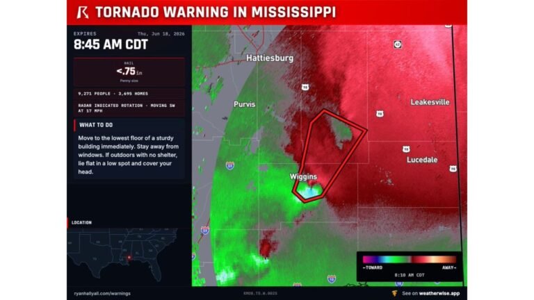
Large Tornado Confirmed North of Effingham, Illinois, Residents in Path Told to Seek Shelter Immediately
EFFINGHAM, IL – A large tornado is actively in progress north of Effingham, Illinois, with Super-Res Doppler radar confirming the storm’s size and intensity right now. Residents in and around the affected area have been issued an urgent directive to seek shelter immediately as this dangerous tornado moves through the region.
Radar Confirms Large and Active Tornado North of Effingham
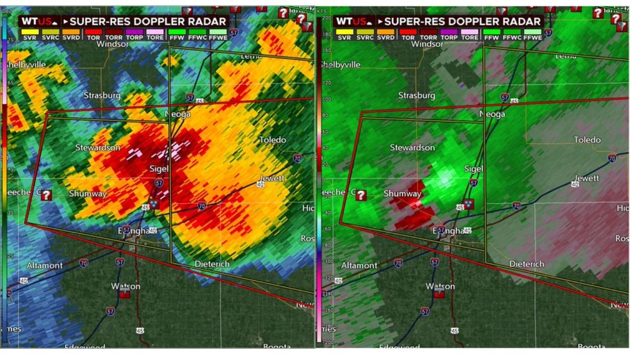
Super-Res Doppler radar is showing a significant and well-defined rotation north of Effingham, with the storm clearly visible across the warning polygon covering communities including Sigel, Shumway, Stewardson, Neoga, and Toledo. The velocity scan on the right side of the radar display is showing a tight couplet of inbound and outbound winds, which is a strong indicator of an actively rotating and dangerous tornado on or near the ground. This is not a radar-indicated threat alone. The size and structure of this storm on both reflectivity and velocity scans points to a large and potentially violent tornado.
Communities Directly in the Warning Zone
The warning polygon covers a concentrated area north and northwest of Effingham. Towns that fall within or immediately adjacent to the threat zone include:
- Sigel – near the core of the storm’s current position
- Shumway – within the warning polygon
- Stewardson – in the direct path
- Neoga – northern portion of the threat zone
- Toledo – eastern edge of the warning area
If you are in any of these communities or anywhere north of Effingham, treat this as a direct and immediate threat to your location.
Seek Shelter on the Lowest Floor Right Now
Do not go outside to look for the tornado. Move immediately to the lowest floor of a sturdy building and get into an interior room away from all windows. A bathroom, closet, or hallway on the ground floor or below ground offers the best protection. If you are in a mobile home, get out now and move to the nearest solid structure. If you are caught outdoors or in a vehicle with no shelter nearby, do not try to outrun the tornado. Find the lowest ground available, lie flat, and cover your head.
What the Radar Is Telling Us Right Now
The dual-panel Super-Res Doppler radar showing both reflectivity and velocity is one of the most reliable tools forecasters have for confirming tornado activity. The left panel shows a large and intense area of precipitation with deep reds indicating extremely heavy rainfall and possible debris. The right panel’s velocity data is showing the classic green and red couplet that indicates strong rotation tightly wound near the surface. When both panels align like this, the threat of a large tornado on the ground is extremely high.
Illinois is no stranger to violent tornadoes and a storm of this radar presentation demands immediate action. Do not wait for a second warning or a visible funnel before moving to safety.
Stay at pinewhispers.net for updates on this tornado and any additional severe weather developing across Illinois today.