Millions at Risk as Flood Emergency Unfolds Across Gulf South, 6+ Inches of Rain Expected Today in Florida, Alabama, Mississippi and Louisiana
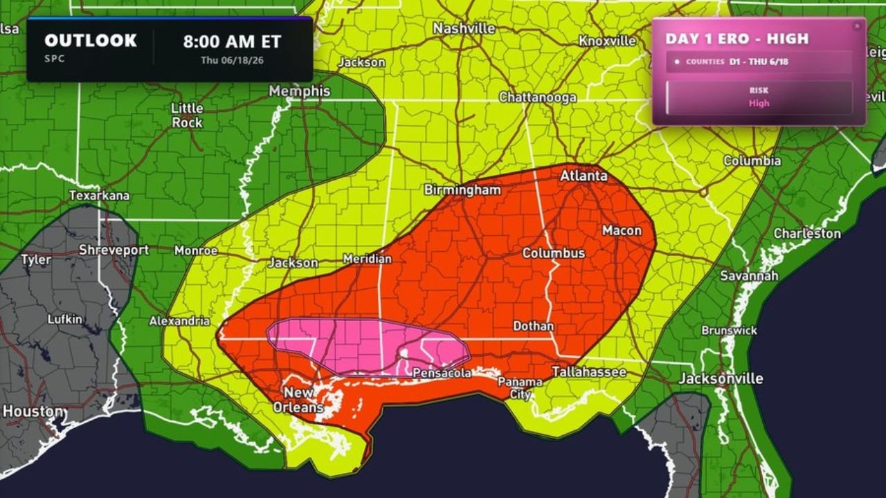
PENSACOLA, FL – The Storm Prediction Center has issued a High Risk for Excessive Rainfall across Florida, Alabama, Mississippi, and Louisiana today, Thursday, June 18, 2026. This is the highest level of rainfall risk the SPC can issue, and it puts millions of residents in the direct path of life-threatening flash flooding and violent tornadoes throughout the day.
6 Inches or More of Rain Expected in the Next 24 Hours
Forecasters are warning that 6 inches or more of rainfall is expected across the affected region within the next 24 hours. In low-lying and coastal areas, totals could climb even higher, overwhelming drainage systems and sending floodwaters into homes and neighborhoods with very little warning time.
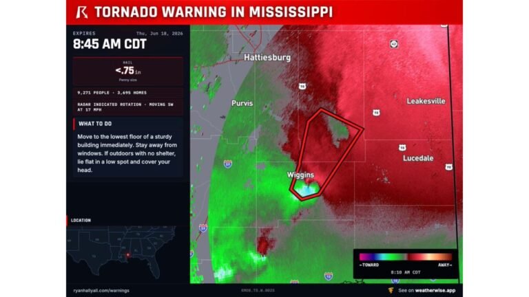
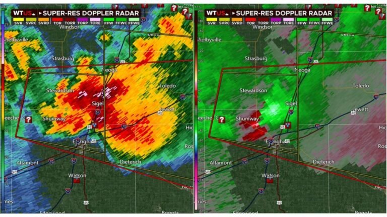
Tornado activity is also expected alongside the flooding threat. This is not just a rain event. Damaging winds and rotating storms capable of producing tornadoes are possible across the entire High Risk zone throughout Thursday.
Pensacola and New Orleans in the Extreme Danger Bull’s-Eye
The most extreme danger zone is centered around Pensacola, Florida and south-central Louisiana including areas near New Orleans. Residents in these specific areas should treat today as a major emergency and take protective action immediately before conditions get worse.
The broader threat extends well beyond the core danger area. Cities including Birmingham, Atlanta, Jackson, and Memphis fall within elevated risk zones and should remain on high alert throughout the day.
Do Not Drive Through Flooded Roads, Move to Higher Ground Now
If you are in any of the affected states, do not wait. Avoid all flooded roadways as just a few inches of moving water can sweep a vehicle off the road. Move to the highest level of your home if floodwaters begin rising. Stay away from windows if tornado warnings are issued for your county. Keep weather alerts turned on your phone at all times today.
Local authorities may issue evacuation orders for the most at-risk communities. If an order is issued in your area, leave immediately and do not return until officials say it is safe.
Conditions Are Changing Fast Across All Four States
This is a rapidly developing and life-threatening weather situation. Stay connected to your local National Weather Service office for the latest updates as conditions change throughout the day.
Stay updated with Pine Whispers for the latest news at pinewhispers.net